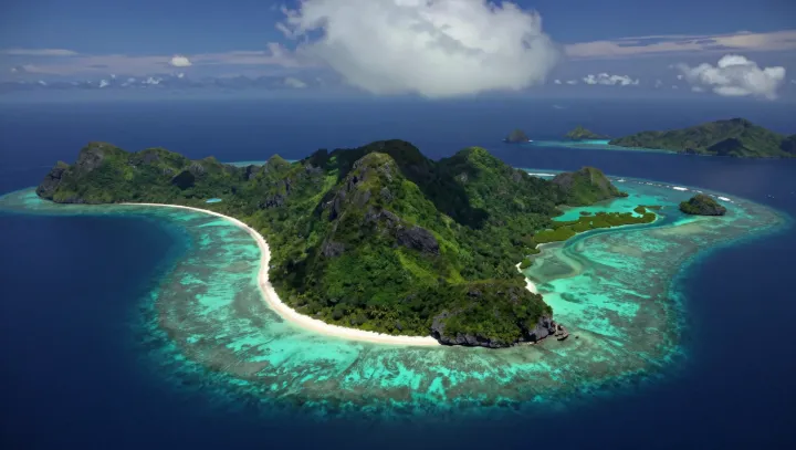
Those turquoise swirls are not art at all; they are code. In shallow reef provinces, water color tracks bathymetry so tightly that remote-sensing specialists can infer depth just from spectral gradients seen in satellite imagery or from a plane window.
What looks random is in fact a physical blueprint. Pale turquoise bands usually sit above reef flats where depth drops below a few meters, forcing incident swell to shoal, steepen, then break along a narrow contour controlled by the carbonate framework and its roughness, a process coastal engineers label wave transformation. Darker gutters mark deeper channels that funnel energy offshore, setting up a feedback loop between wave dissipation, mean water level set-up, and the shape of the lagoon behind the crest.
Future islands are being drafted in the same color palette. Where waves lose most of their energy on the outer crest, they deliver carbonate sand landward as bedload and suspended load, then abandon it in zones of low shear stress that show up from the sky as milky turquoise plumes hugging subtle shoals. Over many storm cycles, those plumes trace preferential sediment transport pathways which slowly build sand cays and barrier ridges, meaning the abstract pattern a tourist photographs today is already a first-order plan for where shorelines will harden into land.